Phase I, which includes construction of the railroad infrastructure by BNSF, was completed in December. Phase II is the construction of the pathway facilities, which will start in 2024. DO NOT ENTER THE CONSTRUCTION SITE UNTIL PHASE II HAS BEEN COMPLETED. Not only is this unsafe, but trespassing on BNSF’s property may result in a ticket or court summons.
Boulder County’s Four-Mile Creek Bikeway project will create a continuous, safe bikeway along SH 119 between Boulder, Gunbarrel, Niwot and Longmont. See the project area map below.
The first segment connected the eastern terminus of the City of Boulder’s Four-Mile Creek Greenway multiuse path with the northbound lanes of SH 119.
The second segment will create an underpass below the BNSF railroad tracks connecting the Four-Mile Creek Bikeway to the Cottonwood Trail.
The project was and will continue to be funded by a combination of a Federal Transportation Enhancement Grant obtained in 2007 and a dedicated fund for trail implementation passed by Boulder County voters in 2001 which was extended by voters in 2007 and 2024.
We are hopeful the new segment will open in the summer or fall of 2024.
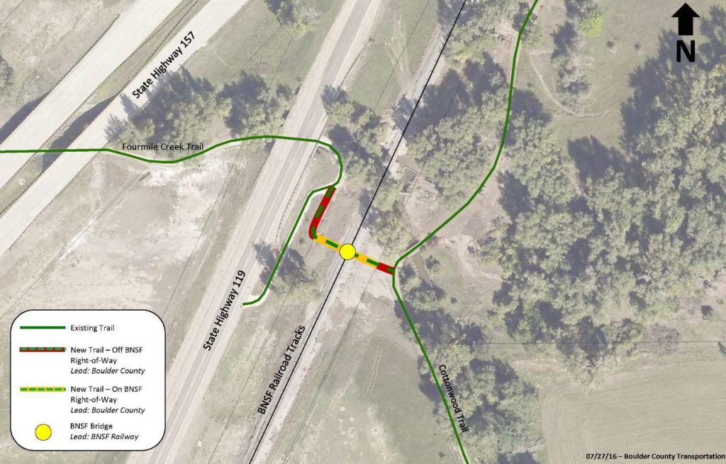
Four Mile Creek Trail Underpass Project Area