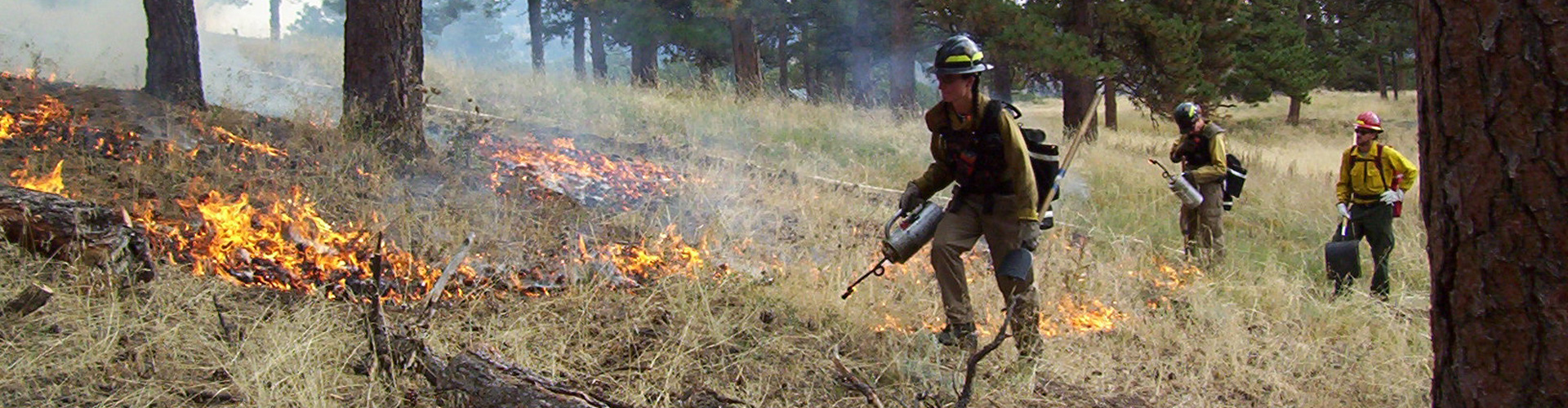
Parks & Open Space and the Sheriff’s Office Wildland Fire Management Program plan to conduct prescribed burns when conditions allow. Smoke and flames may be visible for up to 72 hours. There may be heavy smoke in the air. Please do not call 911 since a controlled burn is not an emergency. The areas will be monitored to ensure fires are completely out.
Prescribed Burn Projects
Smoke and flames may be visible for up to 72 hours after a controlled burn. There may be heavy smoke in the air. Please do not call 911 since a controlled burn is not an emergency. The areas will be monitored to ensure fires are completely out.
Slash Pile Burning
Parks & Open Space and the Sheriff’s Office Fire Management Program will conduct slash pile burns at several locations this winter.
982 piles have been burned as of April 4.
- Hall Ranch (west of Lyons) IN PROGRESS (500 piles burned so far)
- Caribou Ranch (north of Nederland) COMPLETE
- Mud Lake / Sherwood Gulch (north of Nederland) COMPLETE
- Reynolds Ranch (east of Nederland) COMPLETE
- Walker Ranch (west of Boulder) COMPLETE
Burns are scheduled when there is a winter weather system in the area. Operations will be conducted only when there is sufficient snow cover to ensure safe fire operations and containment. Pile burns are conducted to reduce the amount of fuel on the ground as a result of thinning operations. Slash pile burns may require park closures.
Prescribed Burn at Hall Ranch
Jan. 15 – April 15
Nelson Loop Prescribed Burn Project at Hall Ranch.
- Burn window set for Jan. 15 – April 15. Burns can occur any time during the window.
- Burn operations are usually scheduled for one to three consecutive days.
- Property will be closed during ignition days. Park will reopen when deemed safe and if not otherwise closed due to muddy conditions.
- Crews burned on Oct. 11 and Oct. 25 during the previous burn window.
- Burn Area Map
Agriculture and Irrigation Ditch Burning
Jan. 29 – April 30
Agriculture burning is done to remove vegetation to control weeds and prepare areas for reseeding. Irrigation ditches are burned to remove unwanted vegetation for improved water delivery, nutrient cycling, and planting success.
Burn projects depend on ideal weather conditions, including relative humidity, fuel moisture, and wind. Projects will only proceed when conditions are suitable. Fire managers will monitor all projects until they are called out. There may be heavy smoke in the air. Please do not call 911 since these controlled burns are not emergencies.
30,750 feet (5.8 miles) of ditches and 21.5 acres have been burned as of April 4.
- Pella Crossing (11420 N. 75th St.)
- Walden Ponds Wildlife Habitat (3893 N. 75th St.)
- Wambsganss property (12210 Niwot Rd.)
- Marfell Lakes and CMN – Fuhey properties (Arapahoe Rd. and 119th St.)
- Leggett, Ertl, Dougherty, Piazza, Swanson, and Stromquist Farms properties (Hwy. 287, Niwot Rd, Prospect Rd., East Countyline Rd.) COMPLETE
- Alexander Dawson property (109th St. and Jasper Rd.) COMPLETE
- Josephine Roche property (Arapahoe Rd. and 119th St.) COMPLETE
- Wittemyer Ponds, Bailey-Kenosha Ponds, and Wheeler Ranch properties (12086 Mineral Rd.) COMPLETE
- Faul and Kragh properties (115th St., Vermillion Rd., and Wasatch Rd.) COMPLETE
- Doniphan property (115th St. and Lookout Rd.) COMPLETE
- Gaynor Lake (1217 Fox Hill Rd.) COMPLETE
Email & Text Alerts
Sign up to be notified by email and/or text of upcoming prescribed burns.